We demonstrate and advocate for conservation agriculture from the field to the halls of government.
OpTIS
This is your chance to get a (virtual) front row seat for the latest OpTIS research updates! Since you last joined us for an OpTIS webinar, we’ve added data for 2019-2020 and even more states.
We’ll be joined by Prof. Roderick Rejesus of NC State as he’ll describe how he used remote sensing data from OpTIS to study the impact of crop insurance programs on cover crop use. The Operational Tillage Information System (OpTIS), a Regrow technology (https://www.regrow.ag), uses satellite data and a sophisticated algorithm to monitor conservation practices in agricultural systems, including reduced tillage and winter cover crops.
This free webinar event wouldn’t be complete without hearing from Soren Rundquist (Regrow) and Dave Gustafson (CTIC) as they review the latest OpTIS results on the adoption of cover crops across the Corn Belt and elsewhere in the US.
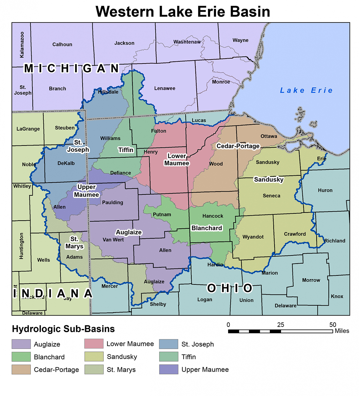
CTIC is leading a new effort to pilot a phosphorus load reduction market in the Western Lake Erie Basin (Maumee, Sandusky, and Cedar-Portage watersheds, see map). Growers within the indicated watersheds are now being sought to
participate in this pilot market.