Join Us May 29 at 12:00 Eastern for a Free OpTIS Webinar!
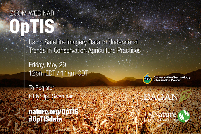
Join us for a Zoom webinar to learn about a new, free, online data tool that uses satellite imagery to study trends in the adoption of conservation agriculture practices. The Operational Tillage Information System (OpTIS) offers a range of applications for government agencies, researchers, carbon market administrators, conservationists and businesses.
During the webinar, you'll hear from the OpTIS developers and others who use science-based data to improve the sustainability of U.S. agriculture. Experts will walk you through the online OpTIS visualization tool to summarize results for the U.S. Corn Belt and demonstrate how you can best use these free resources to advance your own research, planning or validation projects.
Register for the free webinar now at https://bit.ly/OpTISwebinar
Friday, May 29, Noon Eastern/11:00 Central
Check out OpTIS and the powerful visualization tool at ctic.org/OpTIS