OpTIS: Plot Study and Next Step
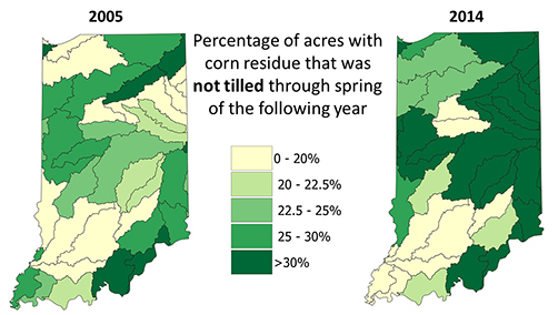
Indiana Pilot Study
Ten years of tillage-transect data collected by the State of Indiana were used to verify the ability of OpTIS algorithms to automatically process publicly-available remote sensing data, in order to accurately characterize tillage practices and the presence of winter cover crops.
Next Step
Building on the success of the Indiana Pilot, CTIC is now again partnering with AGS to apply OpTIS across the entire US Corn Belt (Phase 1). Phase 2 will involve application of OpTIS to all US agricultural regions.